 BP Australia
 Break O'Day Council
 Crowe Horwarth
 Finance Brokers of Tasmania
 6376 2672") Lyndcraft Boats
Lyndcraft Boats Moonraker Antenna Systems
 Scope Insurance Pty Ltd
Pelican Point Depth Profile
Monday 17th October, 2016 at 10:00 am
High tide prediction at St Helens Point was 1.4 metres at 10:00 am
This transect of Pelican Point was taken from the inner navigation markers towards St Helens to the outer markers, eastwards towards the Georges Bay Sea Wall. The readings were taken on a middle track between the green and red navigation markers.
Mariners are advised to take care when negotiating Pelican Point. Caution must be exercised by skippers in interpreting the information below, such as weather conditions, tidal flow and height. The depths are indicative and are a snapshot in time.
St Helens Marine Rescue is available to assist vessels. Contact can be made on VHF Channel 16 or phone 0408 817 359.
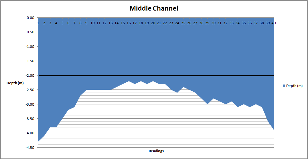
Graphical representation of depth measurements taken at Pelican Point on Monday 17th October, 2016